
Stokes Croft is a stretch of road at the bottom of the A38, an arterial road which for centuries served as the main entrance to Bristol from the North, before being supplanted by the M32 in the 1960s. However, Stokes Croft is also an area of the City, that sits between Kingsdown and St. Pauls. For some the area of Stokes Croft starts with The officially designated Stokes Croft Conservation Area, for others Stokes Croft is an idea. From a government and policing point of view, one side of Stokes Croft is in Cabot Ward, theother in Ashley. For many years policing has been split in the same way between Trinity and Bridewell. Stokes Croft has not been served well by being a boundary.
This is how we look from a satellite.
Stokes Croft’s boundaries are subject to lively debate.
PRSC believes that it makes sense for the outlines of our quarter to follow community. The cultural identity that forms Stokes Croft runs from the junction at the Bath Buildings and Cheltenham Road, down to and including the Bear Pit (formally known as St. James Barton Roundabout).
By the same logic, the 1960’s Council housing known locally as The Dove Street Flats is also part of our community.
Below is the latest version of the Stokes Croft map, according to PRSC. (Click to enlarge).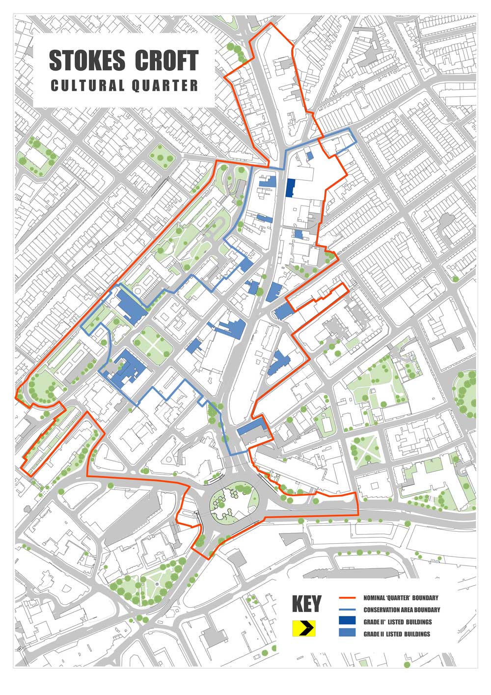
Map: Bryan Thomas: Box Architecture
Proposed extensions to Stokes Croft
This cultural character extends beyond the limits of the Stokes Croft Conservation Area, set out in the map above.
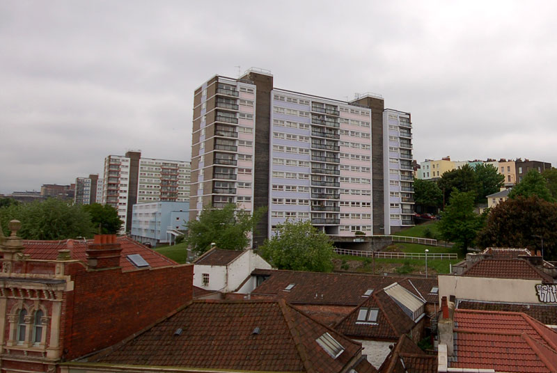
Dove Street (Taken from Westmorland House)
Dove Street Flats: Officially Lower Kingsdown,The 1960s apartments that sit behind Stokes Croft should arguably become part of the Stokes Croft Conservation Area: Residents tend to see themselves more as part of the culture of Stokes Croft than of Kingsdown.
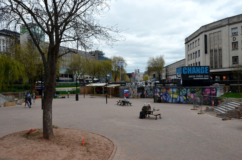
2) “The Bear Pit”, formerly known as St. James Barton Roundabout. Culturally, St. James Barton Roundabout and Stokes Croft have similar roots. Known colloquially as “The Bear Pit” because of its fearsome reputation, this site has been a no man’s land since its creation. This area played host to the famous St. James Fair from the 12th Century. Traders traveled to the Fair from across the known world until it was closed down in the 1830s. The Fair was viewed by Corporation Authorities as a haven for ragamuffins and vagabonds, and, perhaps more importantly, it was extremely difficult to tax given the nature of the commercial activity that took place here.
The Bearpit is now a site of extraordinary experiment. In 2012 enlightened Council officials, in particular Graeme Sims who was then Deputy Chief Executive, declared the space a “Community Action Zone”, further adding that they had no clear idea what that meant! From these interesting beginnings has emerged the Bearpit Improvement Group, a broad based group of locals who have taken on the space, and presided over a refurbishment in conjunction with Bristol City Council. PRSC has been deeply involved in the process: The space is truly experimental, a cultural “commons”, where we can experiment different, incremental and gentle approaches to public space.
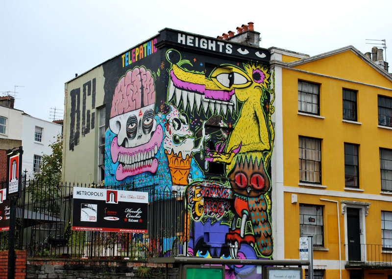
Telepathic Heights on Cheltenham Road. Painting by Burning Candy (2009)
3) Cheltenham Road North. Technically, the northern half of Stokes Croft ends at the junction with Ashley Road. However there exists a natural break, in terms of properties and culture, further up the A38 at the Bath Buildings junction. The various bars and shops along the street have a growing affinity with Stokes Croft culture. The Pipe and Slippers, @the Well, All2Much Gallery etc. all play their part in Stokes Croft’s rich tapestry.